Today's Target
Severe storms are expected to break out later this afternoon from Missouri to Tennessee. The greatest corridor of severe storms appears to be from southeastern Missouri through southern Illinois and Kentucky. The primary threat is damaging winds across the area mentioned but severe hail and a few tornadoes are on the table as well. I'm targeting southern Illinois into western Kentucky where I think more discrete supercellular storms should initiate this afternoon before upscale growth occurs and a more linear system takes shape. This is where I think the greatest tornado and hail threat exists too, although embedded tornadoes are possible throughout the night.
The Setup


 This is just one model run but the 12z HRRR supports the current forecast showing widespread storm development this afternoon.
The Setup


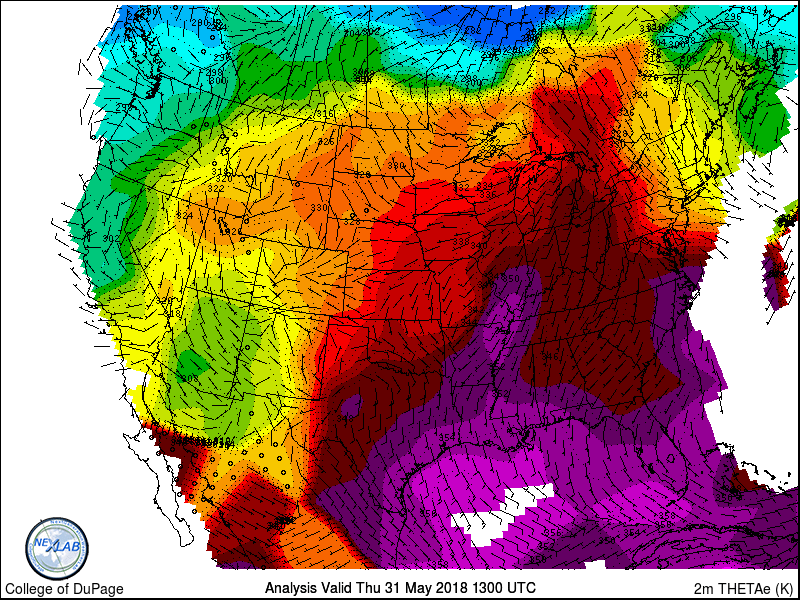


Briefly looking at current obs and mesoanalysis we can see a shortwave trough evident as a subtle cyclonic "kink" in the mid-level flow and a speed max (40kts) over the central plains. Showers and storms are already ongoing with the vertical motion associated with this feature and this could play a role in limiting some development today (although I think storms erupt anyway). A plume of sufficient lapse rates is established over the central CONUS and this will advect eastward atop the moist sector. Surface analysis shows a thera-e axis surging into the region and 70ºF dew points already in place. Ample sunshine and this moisture advection are/will contribute to moderate-strong destabilization across western KY/southern IL. With the advance of the shortwave and upper-level speed max we'll see ascent increase and this should result in more robust storm initiation by late-afternoon.
 |
| 12z HRRR indicates ample destabilization in response to high theta-e air and strong diurnal heating. Note the "blobs" of stable air, that is a result of convection/outflow in that area. |

 |
| This 30-40kt 850mb flow may aid the increase of low-level rotation, especially into this evening. |
With MLCAPE on the order of 2000-3000j/kg and 30kts of deep-layer shear we can expect updrafts to be organized and storms to be strong. Shear profiles are somewhat favorable for rotating cells, especially in the more discrete storms, and I think a risk for hail, and maybe a tornado or two exists. As I said, this is my target today. Storm-relative winds coupled with cold pool interactions will result in upscale growth with perhaps multiple linear segments developing across KY/IL/IN/TN. Embedded circulations will still be possible although the primary threat will transition to damaging winds through the night.
More severe weather is expected the next few days and I'll break that down in this evening's update. It currently looks like the target will be in the northern Plains plains for Friday and back into southeast MO to Western TN for Saturday.
Stay tuned for updates during the next few days as it looks like we'll be putting some road behind us.